The Hereford Mappa Mundi: the world as it was meant to be
In 1300, if you wanted to find England on the largest map then in existence, you had to look in the bottom-left corner — small, vaguely triangular, pressed to the edge while Jerusalem occupied the dead center.
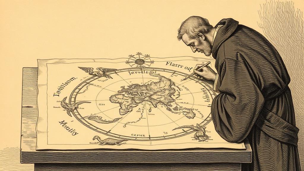
The Hereford Mappa Mundi is drawn on a single sheet of calfskin, 1.59 metres tall and 1.34 metres wide. Over five hundred separate drawings fill its 52-inch circle: 420 cities, 15 biblical events, 33 animals and strange creatures, 32 images of the peoples of the earth, and eight scenes from classical mythology. The Red Sea is painted red. The Garden of Eden, ringed with fire, sits at the very top — east, where medieval Christians expected Christ to return.
The map is attributed to a Lincolnshire cleric named Richard of Haldingham. His name appears near the lower edge in an Anglo-Norman inscription: “To have pity on Richard of Haldingham and Lafford, who has made and planned it, to whom joy in heaven be granted.” No contemporary document confirms the attribution; the prayer is all we have. What we can say is that whoever drew it was not trying to help anyone cross a sea. The T-O structure — three continents divided by the Mediterranean and the Don and the Nile — was a theological diagram. East at the top because that is where the second coming was expected. Jerusalem at the center because Ezekiel said so. Britain in the corner because that, cosmologically speaking, is where Britain belongs.
The map carried that weight in Hereford Cathedral for nearly seven hundred years, where it now hangs under climate-controlled glass. Before the glass, visitors traced their fingers across the vellum until the surface wore through at the spot marking Hereford itself. In 1988, a diocesan financial crisis prompted cathedral officials to announce they were selling it — a private buyer had expressed interest. The public reaction was immediate and furious. The National Heritage Memorial Fund, the J. Paul Getty Jr. Charitable Trust, and a public campaign raised enough money to keep it in place, and a purpose-built library designed by William Whitfield opened in 1996 to house it permanently.
The map’s great cartographic failure is what makes it historically indispensable. It is a poor guide to geography and a rich guide to everything else: what a culture thought the world was for, which places mattered and why, what lived at the edges of the known. Its monsters and marvels — the dog-headed Cynocephali, the men who shade themselves with a single enormous foot — were not ignorance dressed up as geography. They were a record of where knowledge stopped and imagination took over, drawn with total conviction in the same ink as Rome and Constantinople.
Mercator’s grid would eventually flatten the world into latitude and longitude, stripped of theology and monsters. But you cannot understand why Mercator’s map was such a rupture without first seeing what it replaced.
Sources
- Hereford Mappa Mundi — Wikipedia — dimensions, content counts, T-O structure, Richard of Haldingham attribution, Thomas de Cantilupe connection.
- Mappa Mundi Exploration — The Mappa Mundi site — the 1988 near-sale, visitor wear through the vellum, the Whitfield library, structural details.
- Hereford Mappa Mundi — New World Cartographic — the map as cosmological argument, the encyclopedic blending of theology, geography, and mythology.