The Ordnance Survey: how Britain measured itself into existence
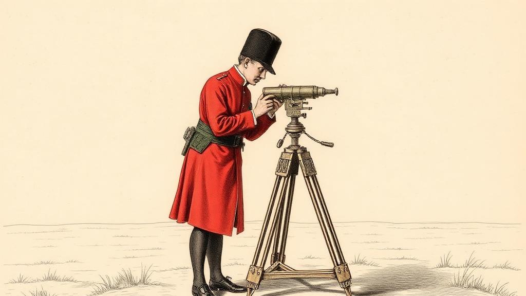
On 21 June 1791, Charles Lennox, the third Duke of Richmond and Master-General of the Board of Ordnance, signed a receipt for one three-foot theodolite, built by instrument maker Jesse Ramsden and weighing approximately 200 pounds (Ordnance Survey). The device traveled around Britain in its own purpose-built carriage for the next 67 years, measuring the angles of an invisible web of triangles stretched across every county. From that receipt, the Ordnance Survey was born.
The need had been building for half a century. After the Jacobite rising of 1745, the British Army discovered — with some embarrassment — that it had virtually no usable maps of Scotland. The Duke of Cumberland dispatched a young engineer named William Roy, twenty-one years old, born in Carluke in Lanarkshire, to fix the problem. Roy spent eight years measuring the Scottish Highlands, producing a map so precise it still impresses working cartographers. The experience converted him: Britain needed a systematic, triangulated survey of the entire island, and he would spend the rest of his life making the case.
He never lived to see it. Roy died on 1 July 1790, eleven months before the theodolite receipt was signed (Wikipedia). There is a further irony in where the theodolite itself came from: Ramsden had originally built it for the East India Company, who rejected the invoice (Science Museum). Lennox bought it instead, and Britain’s national survey launched on an instrument the Empire’s own trading arm had turned away.
The method Roy had pioneered — triangulation — worked by establishing a precise baseline, then sighting from each end of it to a fixed distant point and calculating the triangle formed. Repeat, across hundreds of miles, and the network built itself into a rigorous scaffold of geometry. Roy had proved the technique on a five-mile baseline on Hounslow Heath in 1784, a flat stretch of west London ground that now lies under Heathrow’s runways. His error rate was approximately one part in 100,000, and the Royal Society awarded him the Copley Medal the following year (Wikipedia).
The Survey’s first published product appeared in 1801: a one-inch-to-the-mile map of Kent, England’s most exposed corner against a French invasion that by then had failed to materialise. It sold for three guineas — roughly a week’s wages for a skilled tradesman — and packed roads, rivers, and field boundaries into a density of detail no English county had seen mapped before (Ordnance Survey). Essex followed. Then Sussex. The carriage kept moving north.
The name “Ordnance Survey” did not appear on a printed map until 1810. By then the original military rationale had dissolved — Trafalgar had settled the invasion question five years earlier — but the Survey kept going. Once you start measuring a country precisely, precision turns out useful for things no one imagined at the start: land registry, railway routing, drainage planning, property law. The Survey became the base layer on which Victorian Britain was built.
The Principal Triangulation of Great Britain was completed in 1853, its network of triangles stretching from the Shetland Islands to the south coast of Cornwall (Wikipedia). Roy had imagined it from a hillside in Scotland more than a century before. The triangles he calculated are still the datum on which British maps are registered today.
Sources
- Ordnance Survey official history — founding date, Ramsden theodolite purchase, first Kent map 1801, carriage transport
- William Roy — Wikipedia — Roy’s biography, Carluke birth, Hounslow Heath baseline, Copley Medal 1785, death 1 July 1790
- Ordnance Survey — Wikipedia — institutional history, Principal Triangulation completed 1853, first published maps
- Science Museum blog: Mapping the Nation — Ramsden theodolite origin, East India Company rejection, 200-pound weight, custom carriage